Rongai Gate
Rongai Gate — also known as Nalemuru Gate or Nalemoru Gate — is the northern entry point to Mount Kilimanjaro National Park and the official starting point of the legendary Rongai Route. Sitting at an elevation of approximately 1,950 metres (6,398 feet) above sea level, this remote trailhead near the Tanzanian-Kenyan border offers adventurers a dramatically different experience from the mountain’s busier southern gateways.
Whether you are a first-time trekker or a seasoned mountaineer looking for solitude, unspoiled wilderness, and wildlife encounters on your way to Uhuru Peak (5,895 m / 19,341 ft), Rongai Gate is your starting point for one of the most unique climbs on the African continent. This comprehensive guide covers everything you need to know — from the gate’s location and altitude to the day-by-day itinerary, best season to visit, gear checklist, and summit success rates.
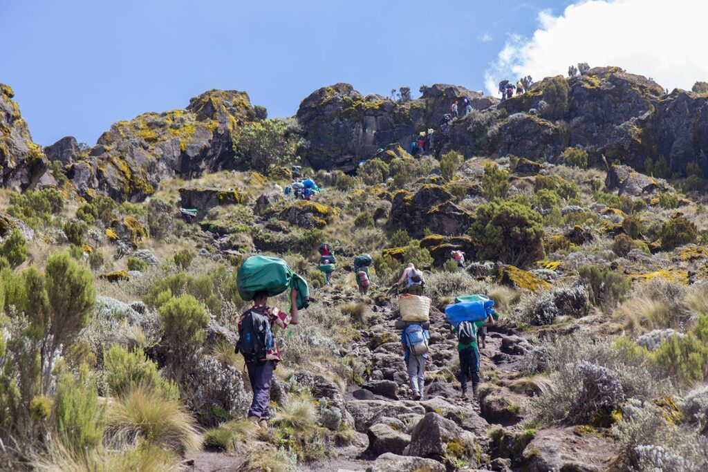
Rongai Gate: Key Facts at a Glance
Also Known As | Nalemuru Gate / Nalemoru Gate / Loitokitok Gate |
Elevation / Altitude | 1,950 m (6,398 ft) above sea level |
Location | Northeastern foothills of Kilimanjaro, near the Kenya-Tanzania border |
Distance from Moshi | ~93 km (approx. 2–3 hour drive) |
Route Access | Rongai Route (Northern Approach) |
Total Route Distance | ~73–81 km (45–50 miles) gate to gate |
Trek Duration | 6, 7, or 8 days (7-day recommended) |
Summit | Uhuru Peak — 5,895 m (19,341 ft) |
Descent Gate | Marangu Gate (southeast side) |
Difficulty | Moderate — gradual ascent, suitable for beginners |
7-Day Summit Success Rate | 70%–90% depending on operator |
Best Visiting Season | January–March and June–October |
Crowds | Lowest of all Kilimanjaro routes (~10% of trekkers) |
Where Is Rongai Gate Located?
Rongai Gate is situated on the northeastern foot slopes of Mount Kilimanjaro, wedged between the rainforest zone and the broader heather zone of the Kilimanjaro ecosystem. It lies very close to the Kenya-Tanzania border — making it the only Kilimanjaro entry gate that faces north toward Kenya rather than south toward the Tanzanian towns of Moshi and Arusha.
The gate sits approximately 93 kilometres from Moshi town, requiring a drive of two to three hours, mostly on unpaved and sometimes challenging roads through rural Chagga villages. Most trekking operators use 4WD Land Cruisers to navigate the route to the gate. The journey itself is scenic, passing Lake Chala — a stunning crater lake on the Kenya-Tanzania border — and offering views of Kilimanjaro’s northern slopes rising above the plains.
The Name Explained
The name ‘Rongai Gate’ is something of a geographic misnomer. The original Rongai Route once began at the border village of Rongai on the Kenyan side, but that access point was closed by park authorities years ago. The trail was then rerouted to start at Nalemuru village near Loitokitok, giving rise to the alternative names ‘Nalemoru Gate’ and ‘Loitokitok Route.’ However, the name ‘Rongai Gate’ and ‘Rongai Route’ remained in universal use among trekkers, guides, and tour operators worldwide.
What to Expect at Rongai Gate
Unlike the busier southern gates such as Machame Gate or Marangu Gate, Rongai Gate maintains a distinctly remote, off-the-beaten-track atmosphere. The compound includes administrative offices of the Tanzania National Parks Authority (TANAPA), a small waiting area, basic toilet facilities, and a parking area. This is where trekkers officially register with Kilimanjaro National Park before beginning their ascent.
Permits are typically handled in advance by your tour operator, who will also process park fees on your behalf. Once registered, the actual trek begins from Nalemuru village, a short distance from the gate itself, where the trail winds through maize and potato fields before entering the forested slopes of Kilimanjaro.
The Unique Landscape Around the Gate
The area around Rongai Gate sits at the transition zone between cultivated agricultural land and natural forest. Government afforestation programs have introduced coniferous tree plantations on the northern side of the mountain, giving the initial landscape a different character from the lush equatorial rainforest found on the southern approaches. A mountain stream flows close to the gate, and trekkers cross it shortly after setting off toward Simba Camp — the first overnight stop on the route.
The gate zone also falls within big game habitat. Elephants, buffalo, antelope, and eland have all been recorded in the wider northern slopes area, and the prospect of wildlife encounters — rare on most other Kilimanjaro routes — adds an element of genuine wilderness adventure right from the start.
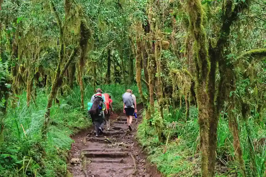
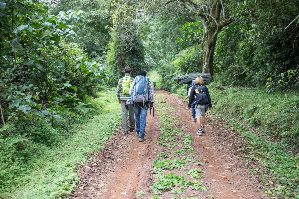
The Rongai Route: Africa’s Quietest Path to Uhuru Peak
The Rongai Route is the only Kilimanjaro trail that ascends from the northern side of the mountain. This single fact gives it a distinctive character that sets it apart from the six other established routes. The trek is a true traverse of the mountain — ascending through the remote, drier northern wilderness and descending via the lush southern Marangu trail — meaning trekkers experience two completely different faces of Kilimanjaro.
The northern side of Kilimanjaro receives significantly less moisture than the southern slopes, because the mountain itself shields the north from the prevailing Indian Ocean weather systems. This makes Rongai the driest Kilimanjaro route, an enormous advantage during Tanzania’s long rains (April–May) and short rains (November) when other routes can be wet, cold, and slippery.
Rongai Route Difficulty: Is It the Easiest Route on Kilimanjaro?
The Rongai Route is widely considered one of the easier routes up Kilimanjaro, second perhaps only to the Marangu Route in terms of gradient gentleness. The ascent profile is gradual and steady rather than steep and demanding, which lowers the physical barrier to attempting the climb. There are no scrambles, no technical sections, and no requirement for previous mountaineering experience.
That said, Rongai has one notable acclimatization weakness: unlike routes such as Machame or Lemosho, it does not offer a ‘climb high, sleep low’ profile — where trekkers ascend to a high point before descending to a lower camp for the night. This means that altitude sickness can affect some trekkers more severely on Rongai than on routes with a more dynamic altitude profile. For this reason, the 7-day itinerary with an acclimatization day at Mawenzi Tarn is strongly recommended over the 6-day version.
Day-by-Day Rongai Route Itinerary (7-Day Standard)
Day 1 — Rongai Gate to Simba Camp
Elevation: 1,950 m (6,398 ft) → 2,600 m (8,530 ft) | Distance: ~8 km (5 miles) | Time: 3–4 hours | Habitat: Rainforest
After registering at Rongai Gate (or completing final permit formalities at Marangu Gate before the drive north), trekkers begin the ascent from Nalemuru village. The path initially crosses maize and potato fields, giving you a glimpse of life in the rural Chagga communities that have farmed Kilimanjaro’s foothills for centuries. The trail then enters the forest, climbing gently through juniper and olive trees — a different forest character from the southern approaches, which are dominated by podocarpus trees. Wildlife sightings are possible here: black-and-white colobus monkeys are frequently spotted in the canopy, and elephant footprints have been recorded along the forest trails. Simba Camp, your first overnight stop, sits at the edge of the moorland zone and offers spectacular views northward across the plains of Kenya.
Day 2 — Simba Camp to Second Cave (Kikelewa Camp)
Elevation: 2,600 m (8,530 ft) → 3,600 m (11,811 ft) | Distance: ~12 km (7.5 miles) | Time: 5–6 hours | Habitat: Moorland
Day two takes trekkers out of the forest and into the open Afro-alpine moorland — a landscape of heather, giant groundsels, and sweeping views that characterises the mid-altitude zone of Kilimanjaro. The trail passes Second Cave Camp (used on the 8-day itinerary) before continuing to Kikelewa Cave. This is a longer, more demanding day but the steady gain in altitude is manageable. The scenery becomes increasingly dramatic as the vegetation thins and Kibo’s ice cap begins to appear on the horizon.
Day 3 — Kikelewa Camp to Mawenzi Tarn Hut
Elevation: 3,600 m (11,811 ft) → 4,330 m (14,200 ft) | Distance: ~6 km (3.7 miles) | Time: 3–4 hours | Habitat: Moorland / Alpine Desert
Today’s hike is shorter in distance but higher in altitude gain, moving into the alpine desert zone where the air grows noticeably thinner. The highlight of this day is the approach to Mawenzi Tarn — a glacial lake nestled beneath the jagged, dramatic pinnacles of Mawenzi Peak (5,149 m), the third-highest peak in Africa. Many guides consider Mawenzi Tarn one of the most spectacular camping spots on the entire Kilimanjaro massif.
Day 4 — Acclimatization Day at Mawenzi Tarn (7-day only)
Elevation: 4,330 m (14,200 ft) | Habitat: Alpine Desert
The 7-day itinerary includes a crucial rest and acclimatization day at Mawenzi Tarn. Rather than remaining stationary, guides typically lead trekkers on a short ‘walk high, sleep low’ excursion to a higher point before returning to camp — helping the body adapt to the reduced oxygen levels. This extra day substantially increases summit success rates and significantly reduces the risk of acute mountain sickness. The tarn itself, surrounded by towering volcanic rock formations, provides a memorable backdrop for a quieter day on the mountain.
Day 5 — Mawenzi Tarn to Kibo Hut
Elevation: 4,330 m (14,200 ft) → 4,703 m (15,430 ft) | Distance: ~9 km (5.6 miles) | Time: 4–5 hours | Habitat: Alpine Desert / The Saddle
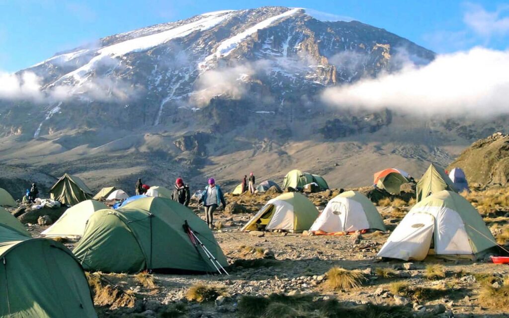
This day takes trekkers across the famous Saddle — the broad, flat volcanic plain that connects Mawenzi Peak in the east with Kibo cone in the west. The lunar-like landscape of the Saddle is one of the most otherworldly environments on the entire mountain, offering unobstructed 360-degree views of both volcanic peaks and the vast Tanzanian and Kenyan plains far below. Kibo Hut, the last camp before the summit attempt, is a spartan stone structure at 4,703 m. After an early dinner, trekkers prepare for the midnight summit push.
Day 6 — Summit Day: Kibo Hut to Uhuru Peak to Horombo Hut
Elevation: 4,703 m (15,430 ft) → 5,895 m (19,341 ft) → 3,720 m (12,205 ft) | Distance: ~21 km (13 miles) | Time: 11–15 hours | Habitat: Arctic Summit / Moorland
The summit attempt begins around midnight, allowing trekkers to reach Gilman’s Point (5,685 m / 18,638 ft) at the crater rim in time for one of the most magnificent sunrises on Earth — the sun rising golden-red over the jagged silhouette of Mawenzi Peak. From Gilman’s Point, the trail follows the crater rim southwest to Uhuru Peak — the highest point in Africa at 5,895 m (19,341 ft). After photographs and a moment of reflection at the summit, the descent via the Marangu route begins, passing through the increasingly lush zones back to Horombo Hut.
Day 7 — Horombo Hut to Marangu Gate
Elevation: 3,720 m (12,205 ft) → 1,843 m (6,046 ft) | Distance: ~20 km (12.5 miles) | Time: 5–7 hours | Habitat: Moorland / Rainforest
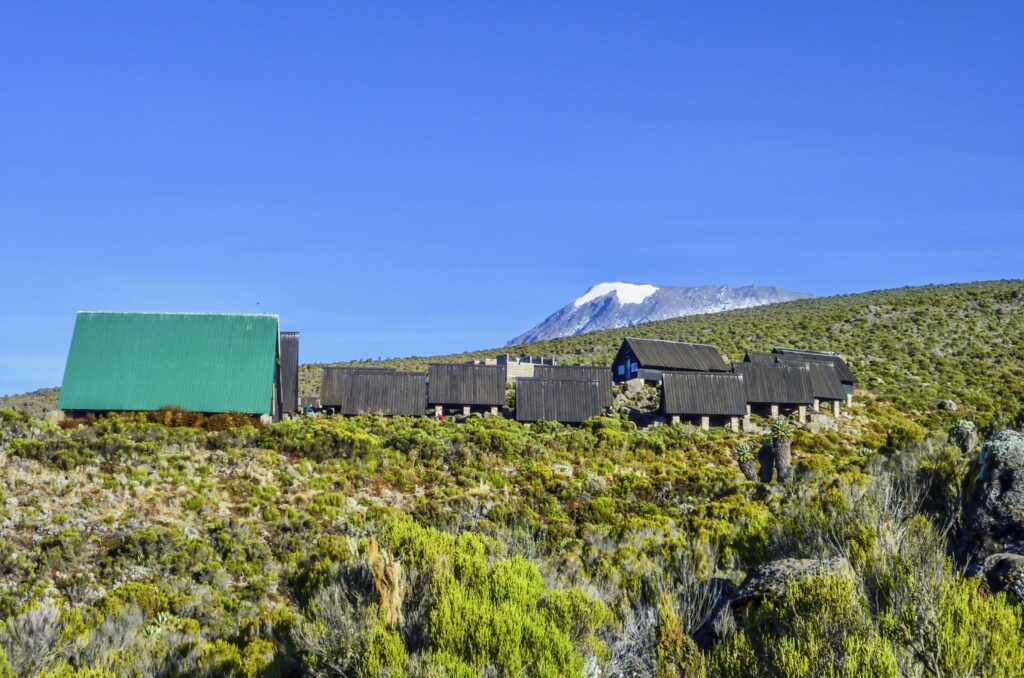
The final day descends through the Marangu route’s lush montane rainforest — a welcome contrast to the stark volcanic landscapes of the upper mountain. At Marangu Gate, trekkers receive their summit certificates: a green certificate for reaching Gilman’s Point, and the coveted gold certificate for those who reached Uhuru Peak. Tips are traditionally given to guides and porters here before the transfer back to Moshi or Arusha for a well-earned hot shower and celebration dinner.
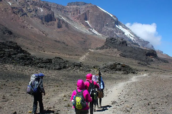
Wildlife Along the Rongai Route
One of the most compelling reasons to choose Rongai Gate as your starting point is the genuine possibility of wildlife encounters — a rarity on most Kilimanjaro routes. The northern slopes of Kilimanjaro form part of a larger ecosystem that connects with the plains of Amboseli National Park in Kenya, and large mammals move freely through the area.
- Black-and-white Colobus Monkeys — frequently spotted in the forest canopy near Simba Camp
- Elephants — footprints, droppings, and occasional sightings reported in the lower forest zones
- Buffalo and Eland — recorded near mountain streams on the northern slopes
- Civet Cats — nocturnal encounters reported by campers at lower altitude camps
- Bearded Vultures — spectacular soaring raptors visible at higher elevations near Mawenzi
- Blue Monkeys and other primates during the Marangu descent
The northern slopes also support a distinctive flora. Juniper and olive trees dominate the forest zone — quite different from the southern rainforest. While the famous giant lobelias and giant groundsels (senecio) are less abundant on the northern ascent, they appear in abundance during the Marangu descent, ensuring trekkers experience these iconic Kilimanjaro plants.
Best Time to Visit Rongai Gate and Climb the Rongai Route
One of Rongai’s greatest practical advantages is its year-round viability. Because the northern side of Kilimanjaro sits in the rain shadow of the mountain, it receives significantly less precipitation than the southern routes throughout the year. However, some seasons are still more favorable than others.
Prime Season: January to March
The months from January to March offer the warmest and driest conditions on the mountain. The skies are typically clear, which means breathtaking views of Kibo and Mawenzi throughout the climb. Temperatures, while cold at altitude, are more moderate than during the mid-year season, and trail conditions are generally excellent. This is an outstanding window for climbing Rongai.
Peak Season: June to October
The long dry season from June to October is the most popular period for climbing Kilimanjaro overall. Conditions are dry and visibility is generally excellent. The trade-off is that even Rongai — the quietest Kilimanjaro route — experiences a relative uptick in trekker numbers, particularly on Sunday group departures in August and September. Nevertheless, the route remains far less crowded than Machame or Marangu during this period.
Rainy Season: April, May, and November
April and May (long rains) and November (short rains) are the wettest months on Kilimanjaro’s southern slopes. On the Rongai Route, the northern approach remains significantly drier, making Rongai the single best choice for trekkers who are restricted to climbing during these months. Rain gear is still essential, but the probability of sustained wet conditions is much lower than on any other route.
Rongai Route: Pros and Cons
Advantages of Starting at Rongai Gate
- Least crowded Kilimanjaro route — attracts only approximately 10% of all trekkers
- Only route approaching from the north — unique and dramatic viewpoints of Mawenzi
- Driest route on Kilimanjaro — the best option during rainy season months
- Genuine wildlife encounters possible — including elephants and colobus monkeys
- Gradual ascent profile — ideal for trekkers with less high-altitude experience
- Complete traverse of the mountain — you experience both the northern and southern sides
- High summit success rate — 70%–90% on the 7-day itinerary
- Short final day before summit push — allows proper rest before the midnight ascent
Considerations and Challenges
- Remote location requires a longer, more expensive transfer from Moshi (2–3 hours each way)
- Higher overall cost compared to some southern routes due to transport logistics
- Less scenic variety compared to Machame, Lemosho, or the Northern Circuit on the ascent portion
- No ‘climb high, sleep low’ profile — slightly higher altitude sickness risk than some other routes
- Limited facilities at Rongai Gate compared to larger southern gateways
Rongai Route Summit Success Rates
Summit success rates on Kilimanjaro vary by route, operator quality, itinerary length, and individual preparation. For the Rongai Route, broadly accepted success rate data is as follows:
- 6-day Rongai Route: approximately 50%–70% across all operators
- 7-day Rongai Route: approximately 70%–90% across all operators
- 8-day Rongai Route: success rates approach those of longer routes, above 85%
The substantial difference between the 6-day and 7-day success rates underlines the importance of the acclimatization day at Mawenzi Tarn. Budget trekkers who opt for the shorter, cheaper 6-day itinerary are significantly reducing their chances of reaching Uhuru Peak. Most experienced Kilimanjaro operators and guides strongly recommend the 7-day version as the minimum for first-time climbers.
How Much Does It Cost to Climb via Rongai Gate?
The total cost of a Rongai Route climb encompasses park fees, guide and porter wages, camping equipment, food, transfers, and the operator’s profit margin. Prices vary considerably depending on the level of service, group size, and operator reputation.
Budget and Group Packages
Budget and group climbing packages via the Rongai Route typically start from around USD $1,700–$2,200 per person for a 7-day climb. These packages include park fees, guides, porters, camping gear (excluding personal sleeping bags and mats), meals on the mountain, and airport transfers.
Mid-Range and Premium Packages
Mid-range packages offering higher quality tents, better food, and more experienced guides range from approximately USD $2,500–$3,500 per person. Luxury Rongai Route climbs with premium camping equipment, private portable toilets, and top-tier guiding services can reach USD $4,000–$6,000 per person.
What Is Typically Included
- All Kilimanjaro National Park fees and conservation levies
- Experienced licensed mountain guides and assistant guides
- Porters for group and personal equipment
- All meals and drinking water on the mountain
- Group camping equipment (tents, dining tent, kitchen tent)
- Airport and hotel transfers in Moshi/Arusha
- Summit certificates upon completion
Note: International or domestic flights, personal sleeping bags and mats, travel insurance, tips for guides and porters, and personal expenses are typically not included. Travel insurance that covers high-altitude trekking and emergency evacuation is essential.
Essential Gear for the Rongai Route
Proper gear is critical to comfort, safety, and summit success on Kilimanjaro. The Rongai Route begins in warm tropical forest and ends in sub-zero arctic conditions at the summit — your clothing and equipment must be capable of handling the full spectrum.
Clothing Layers
- Moisture-wicking base layers (top and bottom)
- Insulating mid-layers — fleece or down jacket
- Waterproof and windproof outer shell jacket and trousers
- Warm hat and balaclava for summit night
- Sun hat and UV-protective sunglasses for daytime trekking
- Warm, waterproof gloves and a liner glove underneath
- Merino wool or synthetic hiking socks (multiple pairs)
Footwear and Equipment
- Sturdy waterproof hiking boots — broken in before the climb
- Trekking poles — strongly recommended for ascent and descent
- Quality sleeping bag rated to at least -15°C (5°F) for summit night
- Sleeping mat (if not provided by operator)
- Daypack (20–30 litres) for daily hiking
- Headlamp with spare batteries — essential for the midnight summit push
- Reusable water bottles or hydration bladder (3-litre capacity recommended)
- High-SPF sunscreen and lip balm — UV radiation is intense at altitude
Health and Safety
- Altitude sickness medication such as Diamox (acetazolamide) — consult your doctor
- Personal first aid kit including blister treatment
- Portable pulse oximeter — useful for monitoring blood oxygen saturation
- High-energy snacks: nuts, dried fruit, energy gels, chocolate
How to Get to Rongai Gate
International Arrival
The nearest international airport is Kilimanjaro International Airport (JRO), located between Moshi and Arusha. This airport receives direct flights from Nairobi, Dar es Salaam, and Addis Ababa, with connecting flights available from Europe, North America, and beyond. Alternatively, some trekkers fly into Nairobi’s Jomo Kenyatta International Airport and travel overland into Tanzania.
Transfer to the Gate
From Moshi or Arusha, the drive to Rongai Gate takes approximately two to three hours (around 93 km from Moshi). Most tour operators handle this transfer with 4WD safari vehicles, as the final section of road to the gate is unpaved and can be in poor condition. Trekkers typically stop at Marangu Gate first to complete permit formalities before continuing the drive around the mountain to the northern side. The scenic drive passes through rural Chagga villages and farmland, with Lake Chala — a beautiful crater lake straddling the Kenya-Tanzania border — accessible as a brief side trip if time permits.
Expert Tips for Climbing via Rongai Gate
- Choose the 7-day itinerary over the 6-day version — the acclimatization day at Mawenzi Tarn dramatically improves summit success rates and reduces altitude sickness risk
- Avoid Sunday departures during peak season (August–October) to minimise crowds at shared campsites
- Begin physical training at least 8–12 weeks before your climb — cardiovascular fitness is the single most important factor
- Stay hydrated throughout — aim for 3–4 litres of water daily on the mountain
- Walk slowly (pole pole in Swahili) — one of the most important lessons on Kilimanjaro is slowing your pace to conserve energy and aid acclimatisation
- Tip your guides and porters generously — these essential mountain crew members are paid low base wages and depend on tips
- Choose a KPAP (Kilimanjaro Porters Assistance Project) partner operator to ensure ethical treatment of porters
- Book your climb at least 2–4 months in advance for peak season dates
- Consider travel insurance that explicitly covers high-altitude trekking above 5,000 metres and emergency helicopter evacuation
- Spend at least one night in Moshi or Arusha before the climb to begin adjusting to the altitude and time zone
Rongai Route vs. Other Kilimanjaro Routes
With seven established routes up Mount Kilimanjaro, choosing the right one is an important decision. Here is how Rongai compares to the other main options:
Route | Duration | Difficulty | Crowds | Success % | Best For |
Rongai | 6–7 days | Moderate | Very Low | 70–90% | Beginners, rainy season, wildlife lovers |
Marangu | 5–6 days | Moderate | High | 50–65% | Budget trekkers, hut accommodation |
Machame | 6–7 days | Moderate-Hard | High | 75–85% | Scenery, varied terrain |
Lemosho | 7–8 days | Moderate | Low | 80–95% | Best overall scenery, high success |
Northern Circuit | 9–10 days | Moderate | Very Low | 90–95% | Maximum acclimatisation, solitude |
Umbwe | 5–6 days | Hard | Low | 60–70% | Experienced trekkers, fast ascent |
Frequently Asked Questions About Rongai Gate
What is the altitude of Rongai Gate?
Rongai Gate sits at an elevation of approximately 1,950 metres (6,398 feet) above sea level, making it one of the lower-altitude Kilimanjaro entry points. The gradual ascent from this point is one of the route’s key advantages.
Is Rongai Gate the same as Nalemuru Gate?
Yes. Rongai Gate, Nalemuru Gate, Nalemoru Gate, and Loitokitok Gate are all names that refer to the same entry point. The ‘Rongai’ name dates back to the original Kenyan border village of Rongai, though the trailhead was relocated to Nalemuru village years ago.
How far is Rongai Gate from Moshi?
Rongai Gate is approximately 93 kilometres from Moshi town, a drive that takes two to three hours depending on road conditions, using 4WD vehicles for the unpaved final section.
Can I climb Kilimanjaro via Rongai Gate without a guide?
No. Tanzania National Parks Authority regulations require all trekkers on Mount Kilimanjaro to be accompanied by a licensed guide. Independent unguided climbing is not permitted on any Kilimanjaro route, including Rongai.
How many days does it take to complete the Rongai Route?
The Rongai Route can be completed in 6, 7, or 8 days. The 7-day itinerary is the standard recommendation, with an acclimatisation day at Mawenzi Tarn providing meaningfully higher summit success rates than the shorter 6-day option.
What is the best season to use Rongai Gate?
The best seasons are January to March and June to October. However, Rongai is the only Kilimanjaro route that is genuinely viable during the rainy months of April, May, and November, thanks to the drier conditions on the northern side of the mountain.
Conclusion: Why Rongai Gate Is Worth the Journey
Rongai Gate may be the most remote and least-visited entry point on Mount Kilimanjaro, but that is precisely what makes it so compelling. For trekkers who value solitude over convenience, wildlife over crowds, and a genuine wilderness experience over well-worn trails, the northern approach via Rongai Gate offers something the busier southern routes simply cannot: the feeling of having the mountain to yourself.
The gradual ascent profile, the driest conditions of any Kilimanjaro route, the possibility of elephant and colobus monkey sightings, the dramatic proximity to Mawenzi Peak, and the unique traverse of the mountain from north to south — all of these combine to make the Rongai Route a genuinely exceptional choice for climbers of all experience levels.
Whether you are a first-time trekker taking your first steps toward Africa’s roof, or an experienced mountaineer seeking a quieter path to Uhuru Peak, Rongai Gate is a starting point worthy of the adventure that lies ahead.