Umbwe Gate
Umbwe Gate is the trailhead and official entry point for the Umbwe Route on Mount Kilimanjaro, the highest peak in Africa and one of the world’s most iconic trekking destinations. Located in the Kilimanjaro National Park in northern Tanzania, Umbwe Gate serves as the launching pad for climbers who choose the Umbwe Route — widely regarded as the steepest, most direct, and most demanding path to the Uhuru Peak summit at 5,895 metres (19,341 feet) above sea level.
Unlike the more popular Machame or Marangu routes that attract large volumes of trekkers, the Umbwe Route and its gate attract experienced mountaineers seeking solitude, raw wilderness, and an uncompromising ascent up Kilimanjaro’s southern slopes. The route through this gate is shorter in horizontal distance but gains altitude far more rapidly than any other route on the mountain, making it both breathtaking and physically demanding.
This comprehensive guide covers everything you need to know about Umbwe Gate: its precise altitude, how to reach it from major travel hubs, the complete 6-day route itinerary through to the summit, what to expect on the trail, and practical tips for a successful climb.
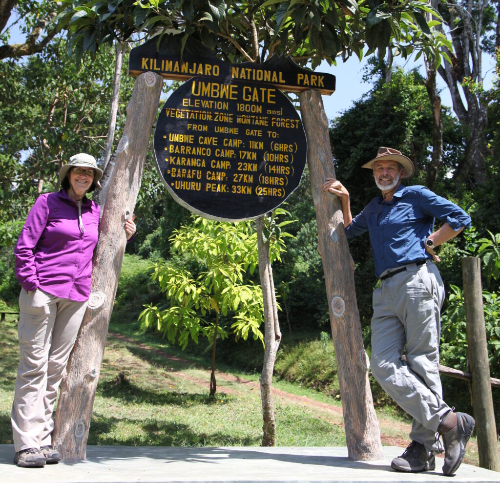
Umbwe Gate Altitude
Understanding the altitude profile of Umbwe Gate and the surrounding camps is critical for proper acclimatisation planning and physical preparation.
Location | Altitude (Metres) | Altitude (Feet) | Notes |
Umbwe Gate (Trailhead) | 1,640 m | 5,381 ft | Official park entry & registration |
Umbwe Cave Camp | 2,940 m | 9,645 ft | First night camp on Umbwe Route |
Barranco Camp | 3,950 m | 12,959 ft | Junction with Machame & Lemosho |
Karanga Camp | 4,035 m | 13,238 ft | Optional acclimatisation stop |
Barafu Base Camp | 4,673 m | 15,331 ft | High camp, summit departure point |
Uhuru Peak (Summit) | 5,895 m | 19,341 ft | Highest point in Africa |
Umbwe Gate itself sits at 1,640 metres (5,381 feet) above sea level, making it the lowest-altitude starting gate of all Kilimanjaro routes. This low starting elevation means that trekkers on the Umbwe Route cover the greatest vertical distance of any route — a total ascent of approximately 4,255 metres (13,960 feet) from gate to summit.
Altitude Gain Rate: The Umbwe Route ascends at an average gradient that is significantly steeper than the Machame or Lemosho routes. From the gate to Umbwe Cave Camp alone, trekkers gain 1,300 metres in just one trekking day, which is unusually steep and presents acclimatisation challenges that demand strong physical fitness.
Altitude Sickness Risk: Due to the rapid altitude gain, the Umbwe Route carries a higher risk of Acute Mountain Sickness (AMS) compared to other Kilimanjaro routes. Proper hydration, a slow and steady pace, and adequate rest are essential strategies at every camp.
How to Get to Umbwe Gate
Umbwe Gate is accessible from the town of Moshi, which serves as the main base for all Kilimanjaro climbers. The gate is located approximately 15 kilometres (9 miles) southwest of Moshi town, near the village of Umbwe. The access road is navigable by 4WD vehicle and most tour operator vehicles.
Step 1 — Getting to Tanzania
The nearest international airport to Umbwe Gate is Kilimanjaro International Airport (JRO), which receives direct flights from Nairobi (Kenya), Dar es Salaam, Addis Ababa, Amsterdam, Dubai, Doha, and several other international hubs. From the airport, the town of Moshi is approximately 40 kilometres (25 miles) away and is typically reached by taxi or shuttle in under one hour.
Alternatively, Arusha — Tanzania’s northern safari capital — is located approximately 80 kilometres (50 miles) from Moshi and is another common arrival point for climbers. Daily shuttle buses connect Arusha and Moshi in roughly 1.5 hours.
Step 2 — Reaching Moshi
Moshi is the central hub for all Kilimanjaro climbing operations. The town is well-served by accommodation options ranging from budget guesthouses to comfortable hotels. Most climbers spend one night in Moshi before departure to organise permits, meet guides, and check gear.
- By Air: Fly into Kilimanjaro International Airport (KIA/JRO), then take a taxi or shuttle to Moshi town centre (approx. 40 min, USD $30–50 by taxi).
- By Bus: Frequent bus and shuttle services connect Arusha, Dar es Salaam, and Nairobi to Moshi. The Arusha–Moshi shuttle runs multiple times daily.
- By Private Transfer: Most tour operators arrange hotel pick-up and drop-off as part of their climbing packages.
Step 3 — Moshi to Umbwe Gate
From Moshi town, the drive to Umbwe Gate takes approximately 45 minutes to 1 hour depending on road conditions and traffic. The route follows the main road toward Mweka before branching off toward the Umbwe area. The final section of road leading to the gate is unpaved and can be muddy during the rainy season, requiring a 4WD vehicle.
- By Tour Operator Vehicle: The most common and recommended option. All reputable climbing operators provide transport from Moshi to the gate as part of their climbing packages. Land Cruisers or similar 4WD vehicles are used.
- By Hired Taxi/4WD: Independent trekkers can hire a taxi with 4WD capability from Moshi to the gate. Agree on the fare in advance (approximately USD $30–60 each way).
- By Public Transport + Walking: A dalla-dalla (minibus) from Moshi can take you partway toward Umbwe village, from which it is possible to walk to the gate — though this is rarely done as the access road is not pedestrian-friendly.
Driving Directions from Moshi
- From Moshi town centre, take the B1 road southwest toward Himo and then turn right (north) onto the road toward Mweka/Umbwe.
- Follow signposts toward Umbwe village. The road passes through lush banana plantations and coffee farms.
- Continue past Umbwe village and follow the track uphill through increasingly dense forest toward the park gate.
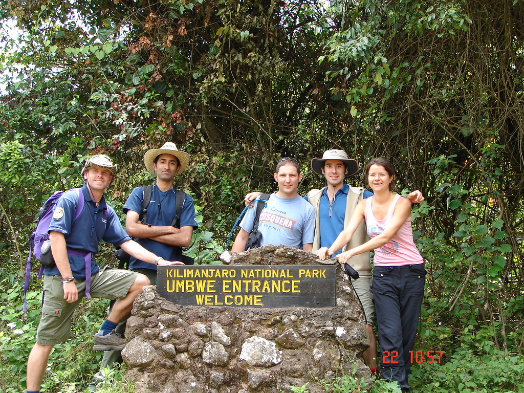
- Umbwe Gate has clear TANAPA (Tanzania National Parks) signage and a ranger station where permits are checked and registered.
Origin | Distance | Travel Time | Recommended Transport |
Kilimanjaro Airport (JRO) | ~55 km | ~1.5 hours | Tour operator 4WD or taxi |
Moshi Town Centre | ~15 km | ~45 minutes | Tour operator 4WD or taxi |
Arusha | ~130 km | ~2.5–3 hours | Shuttle to Moshi + 4WD to gate |
Dar es Salaam | ~570 km | ~8–9 hours (drive) | Fly to KIA + transfer |
Nairobi, Kenya | ~330 km | ~5–6 hours (drive) | Shuttle to Moshi + 4WD to gate |
Umbwe Route — Complete 6-Day Itinerary
The 6-day Umbwe Route itinerary is the standard schedule for this path, though many operators offer 7-day extensions with an extra acclimatisation day at Karanga Camp. The 6-day schedule is aggressive and demands a high baseline fitness level. Below is the complete day-by-day breakdown from Umbwe Gate to Uhuru Peak and descent.
Day 1: Umbwe Gate to Umbwe Cave Camp
Detail | Information |
Start Point | Umbwe Gate (1,640 m / 5,381 ft) |
End Point | Umbwe Cave Camp (2,940 m / 9,645 ft) |
Altitude Gain | +1,300 m / +4,265 ft |
Distance | ~9 km (5.6 miles) |
Estimated Time | 4–6 hours |
Difficulty | Moderate to Strenuous |
Habitat Zone | Rainforest |
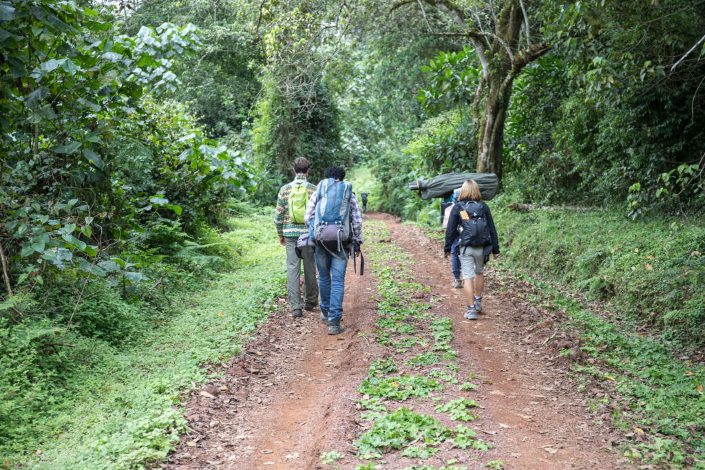
The adventure begins at Umbwe Gate where climbers register their permits and meet their guide teams. From the gate, the trail immediately enters a dense, lush montane rainforest. The path is narrow and root-laden, climbing steeply through giant figs, podocarpus trees, and thick undergrowth draped in mosses and ferns.
Unlike the wider, more gradually ascending paths on the Machame or Marangu routes, the Umbwe trail cuts directly upward with minimal switchbacks. This directness is one of the defining characteristics of the Umbwe Route. Trekkers follow a ridge that runs between the Umbwe and Lonzo river valleys, with dense forest canopy overhead.
Umbwe Cave Camp — the first campsite — is a natural rock overhang or cave site, though most trekkers use tents set up nearby. The camp sits at 2,940 metres and offers the first striking views of the mountain above the treeline. Dinner is prepared by the cook team, and climbers should drink plenty of water and rest well for the challenging days ahead.
Wildlife Note
The rainforest zone around Day 1 is rich in wildlife. Blue monkeys, colobus monkeys, bushbucks, and a variety of bird species are commonly spotted. Listen for the calls of Hartlaub’s turaco and the silvery-cheeked hornbill in the canopy.
Day 2: Umbwe Cave Camp to Barranco Camp
Detail | Information |
Start Point | Umbwe Cave Camp (2,940 m / 9,645 ft) |
End Point | Barranco Camp (3,950 m / 12,959 ft) |
Altitude Gain | +1,010 m / +3,314 ft |
Distance | ~8 km (5 miles) |
Estimated Time | 4–6 hours |
Difficulty | Strenuous |
Habitat Zone | Heath & Moorland |
Day 2 continues the steep ascent as the trail exits the rainforest and enters the heathland and moorland zone. Giant heather trees give way to open moorland with extraordinary views of Kilimanjaro’s southern glaciers and the dramatic Breach Wall — one of the most visually stunning features of the mountain, visible from multiple points along this route.
The trail on Day 2 becomes increasingly exposed, with volcanic rock underfoot and sweeping panoramic views opening up on clear mornings. The path follows the upper Umbwe Ridge, which is one of the most spectacular ridgeline walks on the entire mountain. On clear days, trekkers can see far south across the Tanzanian plains.
Barranco Camp sits in the large Barranco Valley beneath the iconic Great Barranco Wall. This camp is a major junction where the Umbwe, Machame, and Lemosho routes converge, so it can be lively with trekkers from multiple routes. The setting is spectacular — surrounded by giant groundsel (Senecio kilimanjari) and lobelia plants unique to high-altitude East Africa.
Day 3: Barranco Camp — Barranco Wall Climb to Karanga Camp
Detail | Information |
Start Point | Barranco Camp (3,950 m / 12,959 ft) |
End Point | Karanga Camp (4,035 m / 13,238 ft) |
Altitude Gain | +85 m net (significant gain and loss) |
Distance | ~5 km (3.1 miles) |
Estimated Time | 4–5 hours |
Difficulty | Strenuous (involves scrambling) |
Habitat Zone | Alpine Desert |
Day 3 begins with one of the most exciting and memorable sections of any Kilimanjaro route — the ascent of the Great Barranco Wall. This impressive volcanic cliff face rises approximately 300 metres (980 feet) above the valley floor and requires hands-and-feet scrambling in several sections.
The Barranco Wall looks intimidating from below, but with good footwork and a steady pace, it is achievable for most fit trekkers. Guides are expert at leading climbers through the safest line, and the view from the top of the wall — looking back over the Barranco Valley and south toward the Tanzanian savannah — is one of the most rewarding moments of the entire climb.
After the wall, the trail traverses around the southern flank of Kilimanjaro, descending into the Karanga Valley before a short final ascent to Karanga Camp. The net altitude gain for the day is modest, but the physical effort of the wall climb and valley crossing is significant. This traverse section provides excellent acclimatisation through the high-low-high pattern of altitude exposure.
Day 4: Karanga Camp to Barafu Base Camp
Detail | Information |
Start Point | Karanga Camp (4,035 m / 13,238 ft) |
End Point | Barafu Base Camp (4,673 m / 15,331 ft) |
Altitude Gain | +638 m / +2,093 ft |
Distance | ~5 km (3.1 miles) |
Estimated Time | 3–5 hours |
Difficulty | Strenuous |
Habitat Zone | Alpine Desert |
Day 4 is a shorter hiking day in terms of distance but takes place at very high altitude where every step requires more effort. The trail from Karanga to Barafu follows the Southern Circuit path, gradually ascending through barren, rocky alpine desert. The landscape at this elevation is stark and otherworldly — volcanic scree, bare rock, and occasional lenticular clouds circling the summit.
Barafu Base Camp is the standard high camp for the southern routes on Kilimanjaro. The camp sits on a narrow rocky ridge with dramatic views of the Kibo crater rim above and sweeping vistas south across Tanzania. Tents are pitched on rocky terraces, and the camp can feel crowded during peak climbing seasons.
Arriving at Barafu early in the afternoon is recommended to allow maximum rest before the summit push. Climbers should eat a full meal, drink at least 3–4 litres of water throughout the day, and attempt to sleep by 6:00–7:00 PM. The summit attempt typically begins between midnight and 1:00 AM.
Acclimatisation Tip
Some 6-day itineraries combine Days 3 and 4 into a single long day from Barranco to Barafu, but this is not recommended as it reduces crucial acclimatisation time. The Karanga stopover night is strongly advised for summit success rates.
Day 5: Barafu to Uhuru Peak (Summit Night) and Descent to Mweka Camp
Detail | Information |
Start Point | Barafu Base Camp (4,673 m / 15,331 ft) |
Summit | Uhuru Peak (5,895 m / 19,341 ft) |
End Point | Mweka Camp (3,100 m / 10,170 ft) |
Altitude Gain/Loss | +1,222 m gain / -2,795 m loss |
Distance | ~17 km (10.6 miles) total |
Estimated Time | 12–16 hours total |
Difficulty | Extremely Strenuous |
This is the longest, most demanding, and most rewarding day of the entire climb. Guides typically wake climbers between midnight and 1:00 AM for final preparations. Temperatures at this time are often between -10°C and -20°C (14°F to -4°F), and wind chill can make it feel considerably colder. Layering is absolutely essential.
The summit trail from Barafu zigzags steeply up loose volcanic scree and rock through the darkness. The pace is deliberately slow — pole pole (slowly, slowly) is the Swahili mantra that guides repeat throughout the ascent. The thin air at extreme altitude makes every step feel disproportionately taxing. Headlamps illuminate the path, and a long line of torchlights winding upward is one of the most memorable sights of a Kilimanjaro climb.
Stella Point (5,739 m / 18,828 ft) is typically reached around dawn and marks the rim of the Kibo crater. Reaching Stella Point is an enormous achievement in itself, but the summit — Uhuru Peak — lies another 45–60 minutes of walking along the crater rim to the left. The final traverse to Uhuru is comparatively flat but continues at extreme altitude.
At Uhuru Peak, the famous summit sign stands at the Roof of Africa. The views on a clear morning are extraordinary — the vast plains of Tanzania and Kenya stretching in all directions, the remnant glaciers of the Southern Icefield immediately adjacent, and the Kibo crater below. Photographs, celebrations, and quiet reflection fill the brief time at the summit before the descent must begin.
The descent from Uhuru follows the same route back to Barafu for a brief rest and meal, then continues downward via the Mweka Route — a very steep, loose scree slope that provides rapid altitude loss. Trekkers descend all the way to Mweka Camp (3,100 m) in the forest zone, where the warmer air and thicker oxygen are deeply welcome. Total hiking time for Day 5 is typically 12–16 hours.
Day 6: Mweka Camp to Mweka Gate — Descent and Departure
Detail | Information |
Start Point | Mweka Camp (3,100 m / 10,170 ft) |
End Point | Mweka Gate (1,640 m / 5,381 ft) |
Altitude Loss | -1,460 m / -4,790 ft |
Distance | ~10 km (6.2 miles) |
Estimated Time | 3–4 hours |
Difficulty | Moderate (downhill through forest) |
The final day of the Umbwe Route is a straightforward descent through the beautiful montane rainforest to Mweka Gate — the exit point for the Mweka and Umbwe routes. (Note: the Umbwe Route ascends from Umbwe Gate but descends via Mweka Gate, which is a separate gate on the southeastern side of the mountain.)
The descent is mostly on a clear dirt trail through dense forest. Even fatigued legs tend to find this final section manageable, as it is all downhill and the increasing oxygen levels revive energy. Porters often break into song during this final stretch — a joyous celebration of a successful summit.
At Mweka Gate, certificates are collected (summit certificate for Uhuru Peak, or a lower-altitude certificate if the summit was not reached), tips are distributed to the entire guide and porter team, and transport waits to return climbers to Moshi for a well-deserved hot shower, meal, and rest.
6-Day Umbwe Route: Quick Reference Summary
Day | Route Section | Start (m) | End (m) | Distance | Time |
Day 1 | Umbwe Gate → Umbwe Cave Camp | 1,640 | 2,940 | ~9 km | 4–6 hrs |
Day 2 | Umbwe Cave → Barranco Camp | 2,940 | 3,950 | ~8 km | 4–6 hrs |
Day 3 | Barranco Wall → Karanga Camp | 3,950 | 4,035 | ~5 km | 4–5 hrs |
Day 4 | Karanga → Barafu Base Camp | 4,035 | 4,673 | ~5 km | 3–5 hrs |
Day 5 | Summit Night + Descent to Mweka | 4,673 | 3,100 | ~17 km | 12–16 hrs |
Day 6 | Mweka Camp → Mweka Gate | 3,100 | 1,640 | ~10 km | 3–4 hrs |
Best Time to Climb via Umbwe Gate
The Umbwe Route can be climbed year-round, but two dry seasons offer the best conditions for a safe and comfortable ascent.
January to March: Excellent weather with clear skies, cold temperatures at altitude, and lower humidity in the forest. One of the best windows for the Umbwe Route.
June to October: The primary dry season and peak climbing season. Days are clear, temperatures are cold but stable, and visibility from the summit can be outstanding. The most popular period — expect more trekkers at shared camps like Barranco.
April to May: The long rainy season. The rainforest section becomes very muddy and slippery. Not recommended for the Umbwe Route due to the steep, root-laden terrain near the gate.
November: Short rainy season. Conditions are less predictable. Some climbers still attempt the route, but be prepared for significant rainfall in the lower forest sections.
Permits, Fees, and Regulations
All climbers entering Kilimanjaro National Park through Umbwe Gate must have valid TANAPA climbing permits. Independent climbing is not permitted — all trekkers must be accompanied by a licensed guide at minimum. Fees are collected at the gate upon entry.
Fee Type | Cost (Approximate USD) |
Park Entry Fee (per day) | $70–$80 per person per day |
Camping Fee (per night) | $50–$60 per person per night |
Rescue Fee (one-time) | $20 per person |
Guide Fee (per day) | $25–$35+ per day (varies by operator) |
Porter Fees (per day each) | $15–$25+ per day per porter |
Hut/Camp Fee (Crater Camp) | Additional fees apply if used |
Total costs for a guided 6-day Umbwe Route climb typically range from USD $1,500 to $3,500 per person depending on operator quality, group size, and services included. Budget operators cost less but may compromise on guide quality, porter welfare, or equipment.
Essential Gear for the Umbwe Route
Clothing
- Moisture-wicking base layers (top and bottom) — 2 sets minimum
- Insulating mid-layer (fleece or down jacket)
- Waterproof and windproof outer shell jacket and trousers
- Warm insulated summit jacket (rated to at least -20°C)
- Thermal gloves and heavy summit mitts
- Balaclava and warm beanie hat
- UV-protection sun hat or cap
- Gaiters for rocky and wet sections
- Trekking trousers (zip-off recommended for versatility)
- Warm thermal socks — 4–6 pairs
Equipment
- Trekking poles — essential for knee support on steep terrain
- Headlamp with extra batteries (critical for summit night)
- Sleeping bag rated to -15°C or colder
- Sleeping mat (usually provided by operators)
- Daypack (25–35 litres) for daily essentials
- Large duffel bag for porters (max 15 kg)
- Hydration system or 2–3 water bottles
- Water purification tablets or filter
- Sunglasses with UV400 or glacier-rated lenses
- High SPF sunscreen and lip balm
- Personal first aid kit including blister treatment
- Altitude sickness medication (consult your doctor — Diamox/Acetazolamide is commonly prescribed)
Top Tips for Umbwe Gate Climbers
Acclimatise Before You Start: If possible, spend 1–2 extra days at altitude before your climb. A safari in Ngorongoro Crater (1,800 m) or hiking on the slopes of nearby Mount Meru (4,566 m) can significantly improve your acclimatisation.
Hydrate Aggressively: Drink a minimum of 3–4 litres of water per day throughout the climb. Dehydration accelerates altitude sickness symptoms and is one of the most common mistakes on Kilimanjaro.
Choose a Reputable Operator: The Umbwe Route demands highly experienced guides. Choose an operator who pays fair wages to porters, provides proper equipment, and has strong emergency protocols and radio communication.
Go Slowly — Pole Pole: The biggest mistake on Kilimanjaro — and on the Umbwe Route in particular — is moving too fast. The Umbwe Route encourages speed due to its directness, but slow and steady is always the right approach at altitude.
Monitor Symptoms of AMS: Know the signs of Acute Mountain Sickness: severe headache, nausea, vomiting, dizziness, loss of appetite, fatigue, and difficulty sleeping. If symptoms worsen, descend immediately. Never ascend with worsening AMS.
Porter Welfare Matters: Kilimanjaro’s porters carry heavy loads in challenging conditions for modest wages. Choose operators that adhere to the Kilimanjaro Porters Assistance Project (KPAP) partner guidelines and pay and treat their porters fairly.
Leave No Trace: Kilimanjaro National Park is a UNESCO World Heritage Site. Pack out all waste, do not disturb wildlife, and respect the fragile high-altitude ecosystem. Stay on marked trails to prevent erosion.
Conclusion
Umbwe Gate is more than just a trailhead — it is the threshold between the everyday world and one of the most extraordinary mountain environments on Earth. For experienced and well-prepared trekkers, the Umbwe Route offers a uniquely challenging, deeply rewarding, and relatively uncrowded path to the Roof of Africa.
From its forest-shrouded gate at 1,640 metres to the glaciated summit of Uhuru Peak at 5,895 metres, the route demands physical strength, mental resilience, and the wisdom to pace yourself through one of the world’s most dramatic altitude environments. With careful preparation, the right guide team, quality gear, and respect for the mountain, Umbwe Gate marks the beginning of a life-defining adventure.
Whether you are a seasoned high-altitude trekker or a determined first-time Kilimanjaro climber ready for the ultimate challenge, the journey that begins at Umbwe Gate will stay with you forever.